
Travel Guide: The Silk Road // Pakistan to China: Part 1
- Sep 18, 2025
- 4 min read
I'm dusting off my journal. A journal that's travelled some 12,000 km with me through some of the world's most remote, highest and desolate regions and along the ancient trade routes of the Silk Road.
Join me as I revisit the journey of a lifetime made from September to November 2007 from Pakistan across to China, circumambulating China's furthermost western province of Xinjiang, and spanning the entire Tibetan region, from the Aksai Chin in the far West, pilgrimmage around Mt Kaialsh, several weeks sojourn in Lhasa, to the ultra remote Tibetan regions of Qingai, Sichuan and Yunnan Provinces. I'm excited to share this adventure with you; make your self a nice cup of chai, get comfortable, and sate your wanderlust!
For ease of reading, I've broken up this journey into two parts: the first follows my travels from Pakistan's Northern Areas across to Xinjiang, China, and along the ancient Silk Road cities around the Taklamakan Desert. The second part follows my journey from the most Western point of Tibet to it's most Eastern regions..

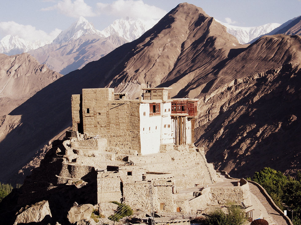
Passu, Northern Pakistan on The Karakoram Highway

Stage one of the journey - through Pakistan to the Khunjerab Pass and border with China.
Part I - Mansehra to Chilas through Kaghan Valley, Northern Areas, Pakistan
Day one | 4 September | Mansehra to Kaghan Valley, Pakistan
Today has been easy going. A short time spent with friends and colleagues in the morning in our office to farewell our home of two years [note: this was after two years of working in Pakistan as a humanitarian aid worker following the catastrophic Kashmir Earthquake of 2005], then off on our adventure! Weeks of planning, dreaming, mapping and scheming is now condensed in my backpack: a handful of history and travel books, a "Learn Chinese in 3 Months" book, a few maps and the blank pages of my journal. I'm too excited for words.
A farewell to Mansehra bazaar as we drove through its familiar streets, and remembering all the hours spent wandering its alleys, its meals of fried liver and tomatoes, the Kashmiri bazaar, sweet chais at dusk… Stopped at Sha-ji’s house for a breakfast of shammi kebabs, fish, omelette and French toast. And then several hours drive along the dusty, land slide-ridden, mountain-hugging road through Kaghan Valley that has been the focus of our work for the last two years.
Each time we passed one of our field offices, we'd stop and say good bye to our colleagues and take chai. Finally arrived in Kaghan town. It was becoming dark and raining so Hajji Makbul, our driver, had to leave so he could make the return journey before any new landslides blocked the road. We spent the rest of the evening whiling away time gupshopping (gossiping) with our colleagues and then a night at the Lalazar Hotel; a hotel built on a friend’s land and hence free for us. And now to bed.


Day two | 5 September | Naran to Chilas via Babusar Pass, Pakistan
This has certainly been a long awaited trip. Luc (my travel companion) and I have discussed taking this route many times and have been very much looking forward to it. We were fortunate enough to have a car and two drivers supplied to us by a colleague for the trip up to the Karakoram Highway. After stopping in Naran for breakfast (omelette, paratha and chai) at 6.30 we set off. 122km over 8 hours. It was a a hell of a long haul over bad roads but the spectacular scenery made up for it.
Up to Besal: perfect roads, wide and green valley with a smattering of small villages and daji houses. Little foliage, only a small amount of potato growing. This whole area is seasonal and witnesses a lot of nomad groups passing through. The Kunhar River is clear and voluminous.


Kuchi Nomads, known locally as Gujars, some coming from across the border with Afghanistan, move down this valley every Autumn towards the warmer and lower plains of Punjab. In Spring they move back up to the mountain plains with their fat-tailed sheep. An incredible sight, something straight out of Kipling's world. These nomadic groups carry their lives on the back of donkeys, setting up tent every night as they pass down the valley.


Besal to Babusar Pass: the road here is only jeepable as we enter a national park. We stopped for chai at the last stop in Besal. Luliputsar (Lake Lulusar) is soon after this. It's the largest lake in Hazara region. The mountains are bare but the valley carpeted in grass. There is evidence of Kuchi nomads and Gujars. Some were still in their tents, others moving down the valley. Through timeless Gettidas village where I was warned by the driver not to take photos and up to the spectacular Babusar pass. From the pass, we can see where the Kaghan Valley curves away towards Azad Jammu Kashmir (Pakistan Kashmir).


Babusar to Chilas: we stopped at Babusar Pass (4173m). Kaghan Valley behind us and the Northern Areas stretching out ahead. It was cold, drizzly and misty and the slate-covered mountains were covered in red and orange lichen. On the Kaghan side, a wide valley with a river snaking through it to Lulipatsar and flat enough areas for the local polo games that apparently still take place in summer.
On the Northern Areas side, the road snaked down through a narrow valley filled with rough wood and stone houses alongside another river forming from the springs around Babusar Pass. The area was lovely; green and bushy along the river and beautiful houses growing up the mountains.

Arrival at dusk in Chilas, where our route through Kaghan Valley and over the Babusar Pass finally met the Karakoram Highway. Chilas is a one horse town and we holed up in a dingy hotel by the side of the highway.


What stands out is how ordinary details—meals, chai, familiar streets, field offices—carry emotional weight. These are not described as extraordinary moments, Geometry Dash but as repeated experiences that have quietly built a sense of belonging. The repeated stops to say goodbye to colleagues emphasize that relationships, more than the landscape itself, define the journey’s importance.